Predominant race by census tract
2023 (ACS, 5-Year estimates)
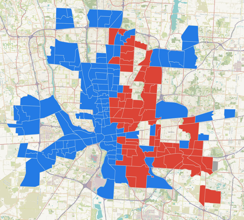
This map is a binary representation of the predominant race in each census tract within the city of Columbus corporate boundary. To be included, the census tract must have at least 75% of its land area within the corporate boundary.
A map with two categories is inherently problematic, as it lumps very different tracts together.
For example, census tract 8.2 in North Linden is categorized as predominantly Black, but it is actually 40.5% Black and 39% white—a very high level of integration.
Census Tract 16, the eastern part of Weinland Park, is 43% white and 35% Black, but it is categorized a predominantly white just the same as census tract 1.10 in Old Beechwold, which is 94.80% white.
Please view responsibly! Learn more about census tracts and data at the U.S. Census Bureau.
Geospatial data source:
- TIGER/Line Shapefiles — used for (1) census tracts and (2) places